AirPixel ViewerCheck every geotag at a glance and take real measurements straight from the photo.
Open a flight folder and flick through it as fast as you can hit the arrow key, with every geotag the payload wrote sitting beside the picture. If the photo carries a laser rangefinder reading, drag a line to get a length (a pipe run, a fence, a crack in a wall) or click round a shape to get its area in square metres (a new footpath, a lawn, a roof you need to inspect), then save the marked-up view for your report with one key.
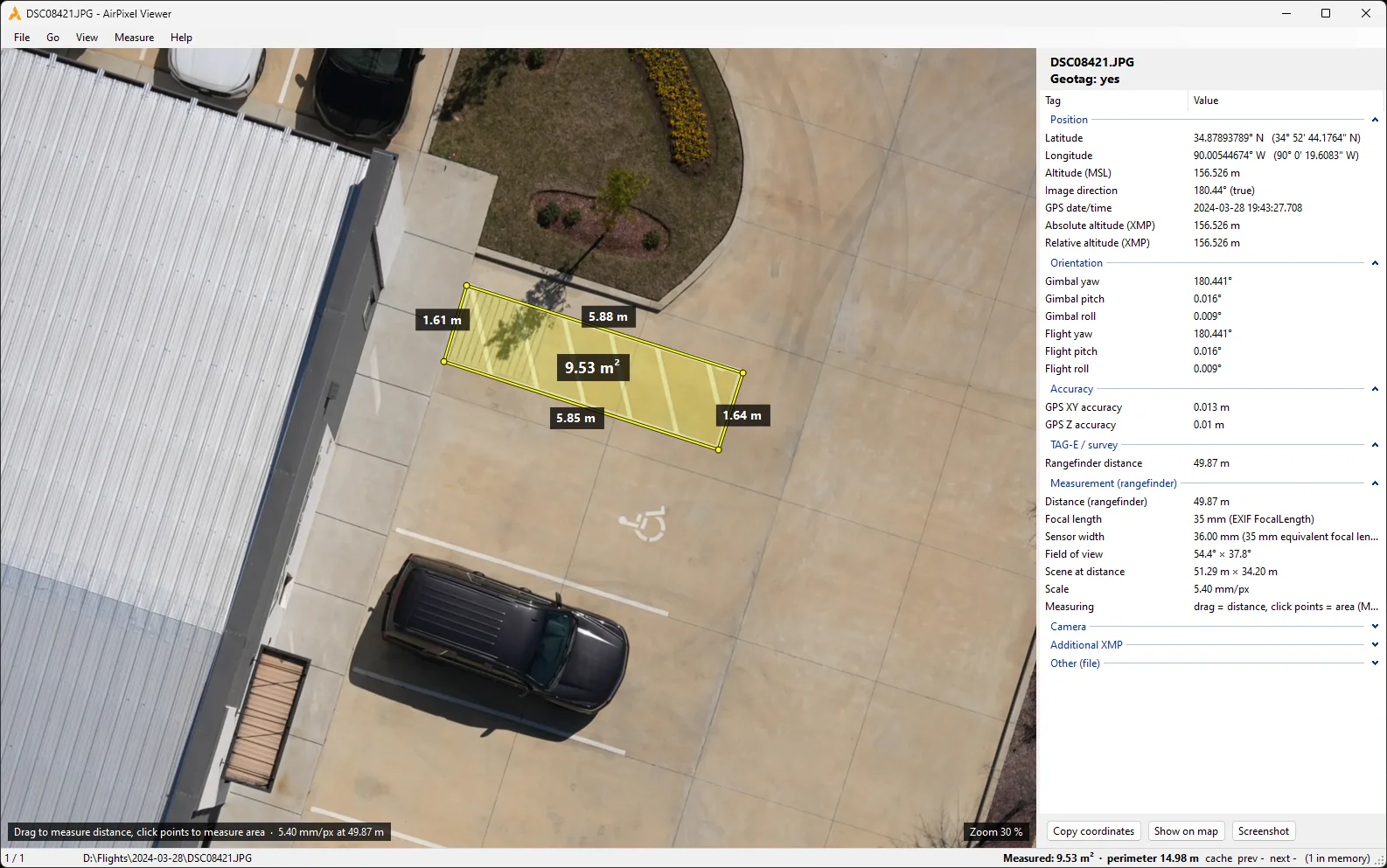
Measure it before you quote it, order it or repair it
Planning work from aerial photos usually comes down to two numbers: how long something is and how much surface it covers. The viewer gives you both as soon as the photo opens, with no processing step and nothing sent off your PC.
Pipes, cables and fences
How many metres of pipe, cable trench or fencing a route needs. For a route with bends, measure each straight run and add them up.
Paths and paving
The area of a new footpath, driveway or slab. Multiply by the thickness and you know how much concrete to order: a 10 cm slab takes one cubic metre for every ten square metres.
Lawns and planting
Square metres of turf or seed for a new lawn, or of mulch for a planting bed, measured before anyone unrolls a tape.
Roofs
How much roof there is to inspect, repair or fit with solar panels. Flat roofs measure true; a pitched roof photographed from above comes out smaller than its real slope.
Cracks and damage
Length and width of a crack in concrete, masonry or steel, and how many square metres of spalling or rust need repair on a pier or a cooling tower.
Gaps, joints and parts
Expansion joints, panel gaps, bolts, insulators, a chipped leading edge on a turbine blade.
Real screen recording, same photo as above: a length, an area, then a saved screenshot.
Measure straight from the photo
Whether it’s a building plot, a roof, a bridge deck or a dam wall, you photograph it from a known distance. TAG-E and ENTIRE R3 record that distance from a laser rangefinder at the moment each photo is taken and write it into the file. AirPixel Viewer uses it to turn the photo into a measuring tape.
- Open a photo taken with the rangefinder.
- Zoom in on what you want to measure with Ctrl + mouse wheel, right down to single pixels.
- Click and drag along a pipe route, a fence line or a crack to get its length. For an area, like a footpath, a lawn or a patch of rust, click round its corners instead and finish on the first one.
- Read the result on the drawing and in the status bar, then press Ctrl+S to save a marked-up copy next to the original photo.
How a laser distance turns pixels into centimetres
No markers on the ground and no processing. All the viewer needs to know is how far away the surface was, which lens was used and which camera took the shot, and every photo from TAG-E or ENTIRE R3 already carries all three. The laser gives the distance; the camera writes its model and lens into the file itself.
At 50 m the photo is about 51 m wide, so one pixel covers about 5 mm of the surface.
What the geotagger wrote, right beside the picture
Checking geotags on Windows is awkward. Right-click a photo, open Properties, and the Details tab shows latitude, longitude and altitude, but none of the camera angles, accuracy figures or survey data TAG-E writes into XMP. Most people end up installing an EXIF tool or loading the photos into mapping software just to see whether the tags are there.
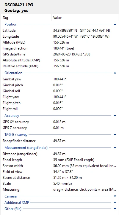
AirPixel Viewer is the quicker way to look. The side panel shows every tag TAG-E writes, grouped the way you'd go looking for them. On a geotagged photo the geotag groups open by themselves; a photo without a geotag says so at the top, so one that slipped through doesn't go unnoticed.
Right-click copies a row into your report. Copy coordinates puts the position on the clipboard and Show on map opens it in your browser. Pix4D-style XMP camera tags and DJI drone tags show up too.
Go through a whole pier or facade, photo by photo
While you look at one photo, the viewer is already loading the one before and the one after, so pressing Space doesn't mean sitting through another 20 MB JPG decoding.
| Action | Keys and mouse |
|---|---|
| Next / previous photo | Space → or wheel down · Backspace ← or wheel up |
| First / last photo | Home / End |
| Zoom at the cursor | Ctrl + mouse wheel · Ctrl+0 fits the photo |
| Pan when zoomed | Middle mouse button drag |
| Measure a length | Click and drag · right-click or Esc clears · M switches the tool on and off |
| Measure an area | Click the corners one by one, then click the first corner again to close the outline |
| Save a screenshot | Ctrl+S or the Screenshot button, saved as photo_meas_01.jpg next to the photo |
| Full screen | F11 or double-click |
| Tag panel on / off | F9 |
| Open photos | Drop files or folders on the window, or double-click JPGs in Explorer after a one-time “Open with” setup |
AirPixel Viewer for Windows
Unzip it wherever you like and run AirPixelViewer.exe. The .NET runtime is packed inside, so there's nothing else to install; the very first start takes a few seconds longer while Windows unpacks it.
Freeware from AirPixel Tech s.r.o., free for personal and commercial use. Measurements and geotag values are for information, so check them before you rely on them. No laser distance in your photos yet? Here's how to wire a LightWare rangefinder.