Notice!This aplication is used to apply text backup log to existing JPG images in EventTEXT or SD Card geotagging mode. Alternatevily can be used in case of failure in DirectEXIF mode.
When this tool is used:
EventTEXT mode
SD Card mode
Direct EXIF mode failure:
Camera battery gets drained during the flight
Camera error occurs during the flight
Camera is being powered off during geotagging
What you need for geotagging:
JPG files from the camera
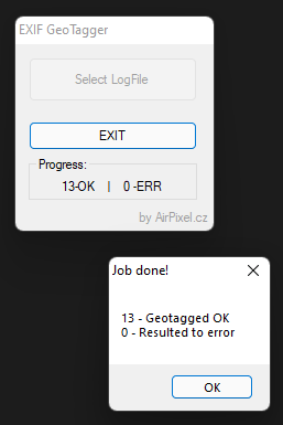
Text LOG file (gpslog_xxxx.txt) from the ENTIRE’s SD card, or in Direct EXIF mode copy saved in the camera SD card (usually not available due to error).
Notice!This aplication is used to apply text backup log to existing JPG images in EventTEXT or SD Card geotagging mode. Alternatevily can be used in case of failure in DirectEXIF mode.
When this tool is used:
EventTEXT mode
SD Card mode
Direct EXIF mode failure:
Camera battery gets drained during the flight
Camera error occurs during the flight
Camera is being powered off during geotagging
What you need for geotagging:
JPG files from the camera
Text LOG file (gpslog_xxxx.txt) from the ENTIRE’s SD card, or in Direct EXIF mode copy saved in the camera SD card (usually not available due to error).